Neighborhood Guide · Historic Downtown & In-Town Powder Springs
Brownsville Road Area, Powder Springs: 9 Things to Know Before You Buy
Where this is: Inside or right next to the City of Powder Springs, a small historic city in southwest Cobb County, about 21 miles northwest of downtown Atlanta.
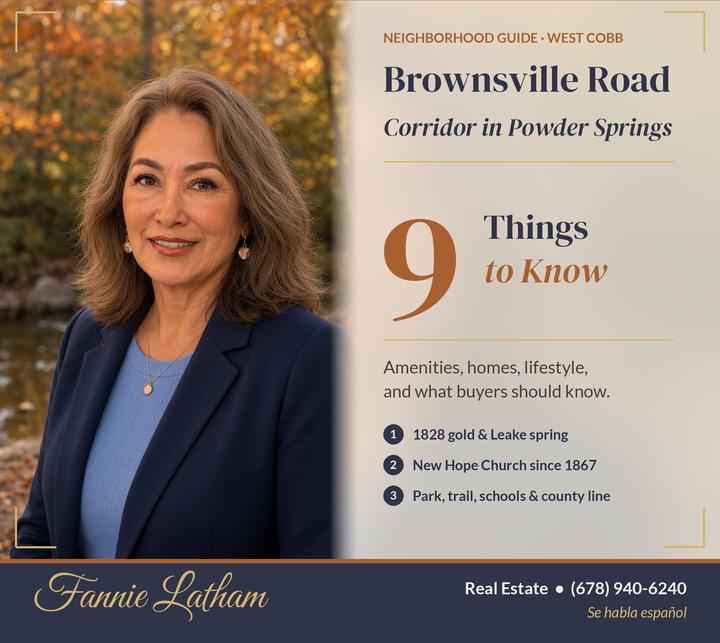
What should you know before buying a home along Brownsville Road in Powder Springs?
Know that this is one of the town's oldest edges — a westbound corridor that starts at Marietta Street (GA 278) downtown and runs out toward Paulding County. The City of Powder Springs and the Seven Springs Museum both place early gold prospecting here: settlers came after gold was found in Georgia in 1828, looking for mines at Lost Mountain and off Brownsville Road. They found little gold. What they found instead became the town — mineral springs, farmland, and a road that still carries people from Main Street into the woods and fields.
Know, too, that Brownsville Road is not one school district or one tax district. Near downtown you are usually in Cobb County (and often inside or next to Powder Springs city limits). Farther out, the road crosses into Paulding County, still with a Powder Springs 30127 mailing address for many homes. That county line changes schools, taxes and who answers a 911 call.
This is the sixth stop in my series on the historic side of Powder Springs. After Historic Downtown, the Marietta and Atlanta Street homes, the old side streets and "the Flats," Lost Mountain, and Macland / McEachern, we turn west at the Brownsville Road corner. For this guide I read the Seven Springs Museum's "Powder Springs Firsts," its pages on the seven springs and the Leake-Lovinggood House, New Hope Missionary Baptist Church's own history, the city's Visitors and Parks pages, TrailLink's Lucille Creek Trail page, Cobb and Paulding school listings, and current Redfin ZIP data.
I'm Fannie Latham, a bilingual (English and Spanish) residential agent based in Marietta. I help buyers and sellers across Cobb, Paulding, Douglas, Cherokee, Pickens, Gwinnett and Clayton counties. Here are the nine things I'd want you to know.
1. Where Brownsville Road Is (and Why the County Line Matters)
Brownsville Road begins at the west edge of historic downtown Powder Springs, at the intersection of Marietta Street / Highway 278. From there it runs generally west / southwest past Powder Springs Park and on toward the Cobb–Paulding county line, then continues in Paulding County.
Most homes along the corridor share a Powder Springs, GA 30127 mailing address. That does not mean every home is inside the city or even in Cobb County.
- Near downtown / the park: many parcels are in Cobb County. Some are inside Powder Springs city limits; others are unincorporated Cobb.
- Farther west: addresses on Brownsville Road can sit in Paulding County, still using a Powder Springs 30127 mail city.
Why it matters: City vs. unincorporated changes property taxes and zoning. Cobb vs. Paulding changes the school district, tax assessor and county services.
Buyer tip: Before you fall in love with a house on Brownsville Road, ask me to pull the county, tax district and school zoning. The road looks continuous on a map. The rules are not.
2. Gold Prospecting, 1828 — and Why the Town Stayed
The City of Powder Springs' Visitors page says gold had been discovered in Georgia about ten years before Springville was incorporated in 1838, and that the first area settlers came looking for gold. They "found little gold in the mines at Lost Mountain and off Brownsville Road," then discovered the seven mineral springs that gave the town its later name.
The Seven Springs Museum's "Powder Springs Firsts 1828 to 1890" (March 19, 2024) puts it this way: in 1828, gold was found in Georgia, including around Lost Mountain and the Brownsville Road area. "However, not much gold was ever found. Those who then stayed, settled the area and began farming."
What it means for you: Brownsville Road is part of the town's founding story. You won't find open mine tours here — the museum and city sources are clear that the diggings did not pan out — but the road is one of the places where "come for gold, stay for the land" actually happened.
3. The Leake Spring at Marietta Street and Brownsville Road
One of Powder Springs' famous seven springs sat (and in the museum's telling, still relates to) the corner where Brownsville Road meets Main Street.
- The museum's "Locations of the Seven Springs" lists a spring "Across Highway 278 (Marietta Street) from the Lovinggood house located at the Brownsville Road intersection between the road and the railroad tracts."
The museum's springs page notes that all of the town's springs were small — none furnishing more than a gallon a minute — and that minerals in the water (silica, sulfur and others listed in an early Geological Survey of Georgia bulletin) turned the sand dark, like gunpowder. That is the story behind the 1859 name change from Springville to Powder Springs.
Please be respectful: these springs are part of private yards, railroad right-of-way and park land. They are not tourist attractions to climb into. Visit the Seven Springs Museum (free admission) if you want the full story.
4. New Hope Missionary Baptist Church — on Brownsville Road Since 1867
Right on this corridor sits one of the most important churches in Powder Springs history.
- The Seven Springs Museum's Firsts timeline: in 1867, New Hope Missionary Baptist Church was organized. "It is a Black Church built by ex-slaves soon after the Civil War ended who wanted a place of their own to worship God. The church is located on Brownsville Road."
- The museum's cemetery page and New Hope's own history (nhmbcps.org) say the congregation separated from Pleasant Hill Baptist Church, worshiped under a brush arbor for three years, then received a donated barn and built a plank church. Reverend Seaborn Rucker was the first pastor. The museum calls it the oldest Black membership church in Powder Springs.
- The New Hope Missionary Baptist Church Cemetery is adjacent to the church. The earliest marked burial the museum records is June 10, 1889 (Tom Middlebrooks). The cemetery was still in use as of the museum's 2019 article (roughly 480–500 graves then).
- The museum's Part II Firsts notes that in 1893, the Liberty Hill School for Black students on Old Lost Mountain Road was consolidated with the New Hope Missionary School on Brownsville Road. New Hope's history also recalls that in 1947–48, while a new church was built, services were held in the "Negro School" on a lot facing Brownsville Road.
Please visit with care: New Hope is an active congregation and cemetery, not a roadside curiosity. If you go, go quietly and for worship or invited events.
(My earlier guide on the old side streets and "the Flats" covers more of Powder Springs' African American heritage. New Hope is the Brownsville Road chapter of that same story.)
5. Powder Springs Park, the Ball Fields and the Path to the Silver Comet
Powder Springs Park sits just west of downtown. Per the City of Powder Springs Parks page, it has a playground, picnic areas, pavilions, restrooms, a passive recreation area with paved trails, and a dog park (separate areas for small and large dogs, dog washes, agility features, shade and water). The city notes the park is adjacent to the Powder Springs Baseball Complex maintained by Cobb County Parks.
Atlanta Area Parks describes about 25 acres, multiple youth baseball fields and batting cages, two playgrounds, and a short wooded passive path across Powder Springs Creek by a historic water pump (one of the mineral-spring sites). From near the north park entrance at Brownsville Road and Powder Springs–Dallas Road, the Lucille Creek Trail (about 1.6 miles of paved path, per TrailLink) runs along Lucille Creek and connects toward the Silver Comet Trail near the Florence Road area / Highway 278 bridge.
Buyer tip: Game days and weekend trail traffic make this stretch lively. If you're looking at a home near the park or the trailheads, drive by on a Saturday in baseball season.
6. The Museum Lived on Brownsville Road First
Before the Seven Springs Museum moved into the Bodiford House on Marietta Street in 2015, it lived in the park on this road.
- The museum's "Powder Springs Firsts Part III" says that in 1984, the George Landers house was moved from Atlanta Street to Powder Springs Park on Brownsville Road and rebuilt to house the museum. The museum opened in 1985 with Sarah Frances Miller as curator.
- In 2015, with the city's help, the museum moved into the Bodiford House, where it remains (free admission; check current hours).
So when you drive Brownsville Road past the park, you're passing the museum's first public home — and one of the springs that named the town.
7. The Homes: Older Lots, Subdivisions and a Mixed HOA Picture
Brownsville Road is a corridor, not a single gated neighborhood. Public listings and map views along the road show a mix of:
- Older homes and farmhouses on larger lots closer to town and out toward the county line (some with workshops, pasture or woods).
- Smaller mid-century and later ranch / cottage homes on half-acre-ish lots.
- Nearby subdivision pockets that touch or feed onto Brownsville Road. (Browns Farm is on my later queue as its own guide — don't confuse the subdivision name with the road.)
Prices: For the three months ending September 2026, Redfin reported a median sale price of about $375,000 ($374,890) in Powder Springs 30127, up 0.2% year over year, with a median of about 59 days on market. That ZIP mixes downtown cottages, West Cobb subdivisions and Paulding-side addresses.
What to check on a home here:
- HOA: Many older road-front homes have no association. Subdivision pockets often do.
- County and city: Cobb vs. Paulding; city vs. unincorporated (see #1).
- Flood maps: Powder Springs Creek and Lucille Creek run through the park corridor. Check FEMA maps for any lot near water.
- Age of systems: roof, HVAC, septic, electrical on older homes.
8. Schools: Confirm the Address — Cobb and Paulding Both Touch This Road
This is the #1 buyer surprise on Brownsville Road.
On the Cobb / Powder Springs side, public listing data for homes on Brownsville Road commonly shows zoning to:
- Cooper Middle School
- McEachern High School
The City of Powder Springs lists Compton ES, Powder Springs ES, Varner ES, Tapp Middle and McEachern High as schools within or just outside city limits — but street-by-street zoning still wins. Cooper Middle appears for some Brownsville Road addresses even though Tapp is the middle school people often associate with Macland.
On the Paulding side of Brownsville Road (still often a Powder Springs 30127 mail address), listing data for homes farther west has shown:
- Hal Hutchens Elementary
- J. A. Dobbins Middle
- Hiram High School
(Paulding County School District.)
Private / other nearby: The Cumberland School has been listed in public geographic directories.
Never assume. Two houses a mile apart on the same road can sit in different counties and different high schools.
9. Commute, Everyday Life and How to Buy Smart Here
Getting around:
- Downtown Powder Springs (shops, Towne Square, museum) is at the east end of the road — often a few minutes from the park.
- GA 278 / Marietta Street takes you toward Austell and into the Marietta / Atlanta grid; westbound routes connect toward Hiram and Dallas.
- I-20 is reachable via local connectors south / southeast (drive times vary with traffic).
- Dallas Highway (GA 120) and the Macland / Lost Mountain corridors are a short hop north for West Cobb errands.
How I'd help you buy here:
- Pin the county and tax district first.
- Confirm school zoning in writing.
- Check HOA / septic / flood before you waive diligence.
- Drive the road at commute time and on a park Saturday.
- Compare comps on the same side of the county line.
That's the Latham touch: local history, honest advice and a lot of heart.
Frequently Asked Questions About the Brownsville Road Area
Is Brownsville Road inside Powder Springs city limits? Parts near downtown and the park can be. Much of the corridor is unincorporated, and the western stretch enters Paulding County. Check the tax record for each home.
Was there really gold here? The city and the Seven Springs Museum both say early settlers prospected at Lost Mountain and off Brownsville Road after 1828, but little gold was found. Farming and the mineral springs are what stuck.
Where is the Leake spring? Museum sources place one of the seven springs across Marietta Street / GA 278 from the Leake–Lovinggood House, at the Brownsville Road intersection between the road and the railroad tracks. Respect private property and right-of-way.
What is New Hope Church? New Hope Missionary Baptist Church, organized in 1867 on Brownsville Road, is described by the museum as the oldest Black membership church in Powder Springs. The cemetery beside it dates its earliest marked burial to 1889.
How much do homes cost? Redfin's median sale price for Powder Springs 30127 was about $375,000 for the three months ending September 2026. Ask me for fresh comps on the Brownsville Road corridor (and specify Cobb vs. Paulding).
Which schools serve Brownsville Road? It depends on the exact address and county. Cobb-side examples often show Powder Springs Elementary, Cooper Middle and McEachern High. Paulding-side examples have shown Hutchens, Dobbins and Hiram High. Always verify.
Is there an HOA? Many older road-front homes have none. Subdivision pockets often do. Verify for each property.
Ready to Find Your Place on Brownsville Road?
Brownsville Road is for buyers who want Powder Springs with deep roots: a gold-rush false start that became farmland, a spring at the corner of Main Street, a park and trail on the way out of town, and a church community that has stood on this road since 1867. It is also for buyers who are careful — because the same road crosses a county line that changes schools and taxes.
I'd love to be your guide. I'll check the county, tax district, school zoning, HOA rules, flood maps and nearby development for any home you like. I'll line up lenders, insurers and inspectors, and walk you through every step in English or Spanish. Call me at (678) 940-6240 or text me to schedule a showing or a relaxed, no-pressure conversation.
Sources
- Seven Springs Museum (sevenspringsmuseum.org): "POWDER SPRINGS FIRSTS 1828 to 1890" (March 19, 2024); "POWDER SPRINGS FIRSTS, PART II, 1891 to 1935"; "POWDER SPRINGS FIRSTS PART III, 1937 to 1993"; "Locations of the Seven Springs"; "The Seven Springs of Powder Springs"; "Historic Homes of Powder Springs, GA" (Leake–Lovinggood House); "New Hope Missionary Baptist Church Cemetery About 1889"
- City of Powder Springs: Visitors / History page (powderspringsga.gov/8/Visitors); Parks page (Powder Springs Park); Public Schools (Cobb County) page
- New Hope Missionary Baptist Church: "Our History" (nhmbcps.org/our-history/)
- TrailLink: Lucille Creek Trail (about 1.6 miles; endpoints include Powder Springs–Dallas Road and Brownsville Road; Silver Comet connection)
- Atlanta Area Parks: Powder Springs Park listing (approx. 25 acres; baseball; historic spring pump; Lucille Creek Trail note)
- Redfin: 30127 housing market page (data through September 2026: median sale about $374,890 / $375K; ~59 days DOM)
- Historical Marker Database: not relied on for this corridor; primary sources above
More guides nearby
Historic Downtown Powder Springs
You'd be buying into one of the oldest town centers in Cobb County, a place that was a mineral-spring resort and a cotton and railroad town long before it was a suburb.
Read the guide →
Historic Marietta Street & Atlanta Street
These are the two oldest residential streets in town, and they have very different personalities.
Read the guide →
The Old Side Streets & “the Flats”
These streets were built by the railroad, the cotton gins, the churches and the families who worked in them.
Read the guide →